The evacuation plan was something that developed over several months. I prepared my initial evacuation plan based on the geography. There is an ocean in one direction and a nearby mountain chain on the other side, so my initial plan had two locations to the north and two locations to the south. There are two drivable routes to each, and there are walkable variations if we have to go to a contingency plan along the way.
When I did my area study, I discovered some additional factors, such as the blast area of a liquid natural gas processing plant and major underground natural gas pipes. I also discovered an active fault line that could affect the roads and bridges for one of my routes.
Once I corrected for these factors and plotted my new routes, I did a route recon. My initial route recon was just to use the street view on Google Maps to look at portions of the routes I do not routinely go through. I had to make another correction because one of the roads that looked like it connected was actually a dead-end and a footbridge had been installed over the arterial road.
Then, I drove the driving routes, looking for conditions that could change my plan or become factors while en route. Areas that could become choke points if certain roads were blocked or there was civil unrest.
Once I was satisfied with the driving routes, I looked at the walking routes. In many cases, the walking routes paralleled the driving routes, so I could shift to the walking route at any point if I needed to. However, the walking routes were off the main roads to the greatest extent possible and took advantage of being able to travel in places a car cannot.
I did not walk the entire route. I did walk portions at a time, though. What do the people wear? How do they walk? How do they act? In other words, what is the baseline on the routes? When and where does it change? How do you blend in? To what extent can you completely avoid others altogether?
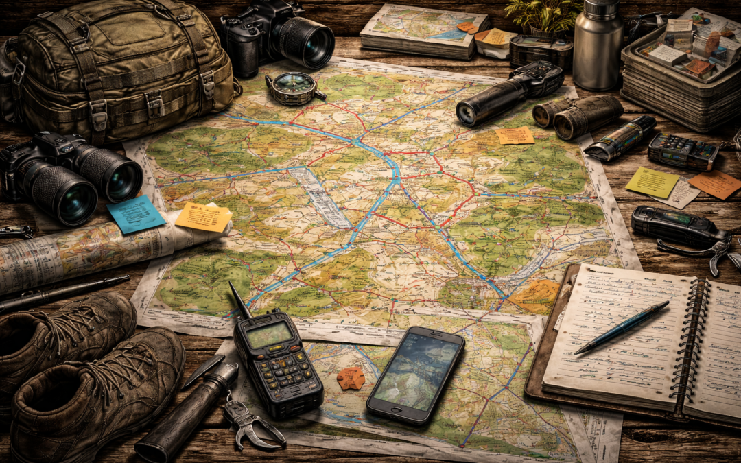
Once all your routes are established and verified, create waypoints along the way, such as parking lots, gas stations, restaurants, and hotels. Consider if the situation requires you to leave right now. Another family member is in a different part of town, and there is absolutely no chance you can link up right away, and communication is sketchy or out.
If the plan is known to the entire team/family, you get a text that says, “Grandma’s house. Route 2” Would they know what to do? Maybe the plan is for everyone to meet at the first waypoint on the route out of the affected area. Wait for 30 minutes, and then go to the next waypoint. Or if you have a straight shot to stay ahead of the crowd, go directly to Grandma’s house. Whatever the plan is, everyone needs to know it, and strip maps and information need to be under the seat of every vehicle in the family or however you decide to manage the information.
Depending on how far you are traveling, you may want or need to plan for a hotel stay in route. Your plan should include the locations and phone numbers of the hotels along the way. If you call and book a room right away because you know you will need a room tonight, you want to be able to do that before everyone else realizes they will need a room as well. If you book it at 10 am and they realize they need it at 5 pm you are ahead of the curve.
Depending on the terrain and distance, you may opt to put caches in place ahead of time. What items will you need if they are consumed or you are robbed along the way? Mark them on your map, calling them something other than “cache.” Maybe something like “Checkpoint 7 123 456” for the Checkpoints with extra numbers representing direction and distance or another method known only to your group.
We recently walked the El Camino de Santiago de Compostella in Spain. Despite 6 months of training hikes in urban environments, the Camino still proved challenging because you might walk 15 miles in a day, now do it again, and again, and again. We walked about 120 miles and accumulated some minor injuries along the way. Having the experience of knowing how to take care of the injuries before they become major injuries was invaluable.
Repeatedly assessing urban layouts and security was a great reminder of the importance of practicing these skills in unknown environments.
We had the convenience of doing all this in a permissible environment. How different would it have been in a non-permissible environment where security was even more important, competition for resources existed, and sources of water had a major impact on your movement?