In the military sense, Intelligence Preparation of the Battlefield, or the Area Study, gathers information about an area’s physical, social, military, economic, and government environments before taking action.
I don’t suggest you follow the military model. It’s too much time and effort, and it’s probably not as informative as what I suggest.
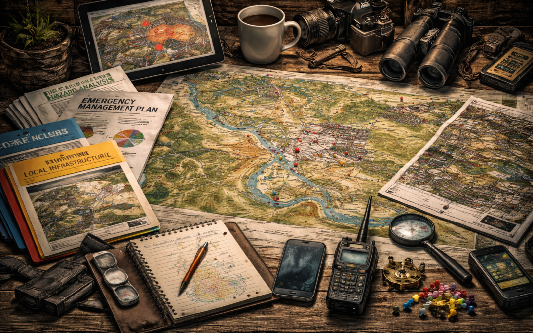
If you live in the United States, the Federal Emergency Management Agency (FEMA) gets a lot of your tax dollars to make plans and to financially incentivize local governments to make plans. And while I have yet to see an impressive performance from FEMA, I have seen the local products developed from those FEMA dollars.
The Hazard Analysis and Mitigation Plan and the Emergency Management Plan—sometimes two separate documents, sometimes a single document—are publicly available at the State and County levels and should also be available for most cities and towns.
Sometimes, they are very well done, and sometimes, they are severely lacking. The Hazard Analysis and Mitigation Plan describes each threat to the local city or county. Threats should include natural hazards such as wildfires, earthquakes, hurricanes, tornadoes, etc., as well as technological threats such as fire, riots/civil disturbances, strikes, and infrastructure failures like bridges, electrical, water, communication, internet, etc.
They usually cite past occurrences of the hazards in your area as well as the effects they had, the response, recovery efforts, timelines, cost, and long-term impact. They should then describe what measures that level of government has put in place to mitigate those effects in the future. Usually, the Emergency Manager or the Fire Marshall is tasked with developing the hazard analysis. Emergency Managers, police, fire, public works, power companies, etc. are tasked with developing the mitigation measures.
The Emergency Management Plan describes the overall response from that level of government in an emergency and tasks certain agencies with response duties. It may also set precedence and priority for the restoration of services. It may be helpful for you to know that in a major electrical outage or blizzard, access and power to hospitals are the first priority. If a hurricane makes roads impassable, bus routes are considered main arterials and will be cleared first. These, of course, are just examples. Each city or county will set its own priorities. Knowing what the plan is or that there is no plan is good for you to know.
The Emergency Management Plan will often include the criteria to establish the Emergency Operations Center and the specific radio communications involved. This includes what communications nets will be in place, who reports on what, who monitors what, and the specific frequencies to use. Many police and fire nets that are normally encrypted may become unencrypted as various agencies have to work together. This alone is gold. It may allow you to track critical events in real time.
So far, we have examined Hurricane Hugo in Charleston, South Carolina, Hurricane Katrina in New Orleans, Louisiana, and the train derailment in East Palestine, Ohio. Now, let’s examine the Hazard Analysis and Mitigation plans for each location in relation to the specific disaster they experienced.
Charleston SC
The Charleston hazard and mitigation plan does a great job of addressing hurricanes. It addresses four different types of flooding, identifies critical infrastructure affected by floods, references several ongoing erosion and drainage mitigation projects, and establishes evacuation zones and routes. It has a practical step-by-step hurricane preparedness plan that includes preparations, actions during the event, and how to deal with the aftermath.
New Orleans LA
Similar to the Charleston plan, the New Orleans plan is very comprehensive regarding hurricanes and flooding. Additionally, it covers critical infrastructure failures, including levees, bridges, highways, and buildings. They even have an additional plan for communicating with and evacuating tourists.
East Palestine OH
The township was too small to have a comprehensive emergency plan. However, Columbiana County does have a very comprehensive plan. The plan was published in 2019 and included a detailed portion of hazardous materials. It even cited 19 previous rail mishaps that included hazmat releases. The next step in their mitigation actions was to conduct a commodity flow through inventory. That action item was due in 2024. The derailment and release occurred in 2023.
The development of their plan was a multi-year event that had not been completed at the time of the train derailment, hazardous material spill, and burn.
If your city does not have a published plan, check the county and state emergency management agencies.
Area Threat Assessment
This is the location of your residence, the neighborhood, and the immediate vicinity. This is the location you will be “operating” in. You will be concerned about security, disaster impacts, transportation, power, water, and food. You may also need to study the location of your work and the transportation corridor in between.
Once you have looked through the state, county, and city mitigation and emergency response plans, you will have a good feel for collecting, assessing, and planning for the hazards that affect your tactical area. If you start by identifying the boundaries of your tactical area, then take notes that will affect that area as you go through the other plans, the area assessment will practically write itself in terms of identifying the threats.
This will better inform your planning for food, water, power, security, medical and sanitation, communication and evacuation needs.
As we go through this process, you can refer to Appendix A Contingency Plan to see the finished product.
First, we need to identify the specific areas we are interested in. For most people, this will be where we live, where we work, and the connecting corridor.
I used Google Earth, created a new layer, and dropped a pin on my house and another on my business. I then created a polygon that enclosed both locations, the routes I use to travel between them, and an adjacent park. Activities at any of these locations can directly affect me.
On a larger scale, any major event within the city has the potential to affect me directly. So now it is time to use those tax dollars and take advantage of all the research and planning that the city has already done.
This is the Fire/EMS hazard assessment:
The city has assessed that the fire hazards of buildings in this area are 220 high risk, 7,566 moderate risk, and 2,974 low risk. Only 209 high acuity EMS responses. Overall, fire/EMS response time is 3 minutes.
The age of residents here is 33% under 25, 34% 25-49, 21% 50-64, and 10% 65 or older. The median age is 41.8.
The population is 89% white, 1% Native American, 5% Hispanic, 2% Asian, 2% African American, 5% mixed race, and 1% other races.
The median household income is $87,337. Land use is 90% single-family and 10% business. The median home value is $356,717. There are 94 vacant buildings.
One note here is that the city has encouraged many Detached Accessory Dwelling Units, meaning many houses in this area have a smaller apartment on the land. This means the 90% single-family dwelling number is technically incorrect and possibly household income as well.
No hazardous materials are used or stored in the area. But they are transported by a rail line that traces the coast. The train tunnel has been assessed as an underground hazard.
A fault line runs right along the edge of the water line through this area. Two other fault lines exist within the city.
There is no danger of flooding, mudslides, or tsunamis in this area, but the city itself has areas threatened by all three.
There is no danger from natural gas pipelines in this area, but three major pipelines are adjacent to the port.
Transportation
Prioritizes debris/ice removal for hospital access, then bus routes, as they are the city’s main arterials. They also specify the need to be self-sustaining for 14 days versus the typical 72 hours. My area is not reliant on any bridge, rail, or ferry system.
The impact here is that the major routes that would be used between the home and business on our map are among the first to have access restored. However, the main arterial to the Interstate is among the most vulnerable. This means alternate routes are even more important, and decisions to evacuate may have to be made sooner.
Communication
The city’s communication priorities are internal communication among emergency services, public utilities, and external agencies such as the Amateur Radio Emergency Services (ARES) and the American Red Cross. As well as public information and warnings.
The city owns one-third of the communications systems in the city, which are all vulnerable to weather and earthquakes. The city will repurpose any surviving systems for emergency services. The priority of restoration is life-sustaining activities, followed by basic human needs and transition to recovery.
Even though I am not an ARES member, it will be worth monitoring their emergency radio net since it will be unencrypted.
Mass Care
This covers temporary shelter, food, evacuee support, distribution of emergency supplies, and coordinating restoration of impacted supply chains. A portion of the plan relies on assistance from the American Red Cross. Shelter and distribution sites shall be public assembly buildings and libraries.
My biggest takeaway from this section was determining the three closest shelter/distribution centers to me so I could plan for movement and security back and forth during a crisis.
Energy
The order of repair is transmission lines, substations, feeder lines to streets, tap lines to 20-30 homes, then individual homes.
I found the location of the substation that supplies my house and its historical outage is at less than one outage every five years.
From there, I go to the county emergency management plan to see if additional information may impact my planning. At the county level, I am especially watchful for threats that might impact me if I have to evacuate.
Civil Disturbance
The county hazards assessment noted that this area has had a history of civil disturbances from the late 1800s through to 2021. They identified three county cities with sufficient population density and environment that could result in future civil disturbances. My city is one of those three. Additionally, two main roads that would be primary routes for evacuation are listed as high-probability disturbance corridors.
Terrorism
There have been 15 acts of terrorism in the county and the surrounding areas. Five had an international connection; ten were domestic. Radicalization of local groups began in the winter of 2018 and are encouraging leaderless acts to destroy human life and disable critical infrastructure.
The most useful information from the State plan is that Western Washington is situated between a mountain chain and the ocean. One north-south interstate and three east-west mountain passes are the only routes available for supplying the region by truck.
It is possible, in fact, likely, that certain hazards can prohibit transport on all four highways at once. Heavy precipitation frequently snows in the mountain passes while it also floods out the interstate south of Olympia. Similarly, an earthquake could block the passes and damage interstate bridges. This city’s police department has an interactive crime dashboard allowing you to look at the city as a whole or as a part of the city. It shows types of crimes, locations, and trends such as day of week and time of day. It also allows you to separate out gang-related crimes and crimes against society. Many cities have some version of the tracker, sometimes real-time, sometimes with a delay.
At this point, we have identified the areas of interest, gathered relevant fire and police data, and compiled a list of hazards, possibly with mitigation measures, priorities to restore services, demographics of the area, possible historical accounts, and those outcomes. We may have a working idea of emergency management procedures, methods of communication, shelter, and aid distribution points.
Overall, we should have a pretty solid idea of the threats in our area. However, if there are still gaps in your information, the US Census Bureau is a great resource. It has a variety of maps and data, including demographic, economic, and topical data like food scarcity.
Terrain Analysis
Once we have an idea of the big picture, we need to examine the immediate area surrounding your home, work, and travel corridor more closely.
Starting with key terrain meaning terrain, or a terrain feature, that is going to give an advantage to whoever controls it. It may be a hill or ridge, a field large enough to support an operating base or air operations, or an electrical substation or other critical infrastructure. Remember, if we consider an occupation force in our assessment, we need to consider terrain as they would use it. If we are not concerned about a government-supported force, we only need to consider terrain as other groups, such as criminals, would use it.
In this case, the longest line of sight is 150 yards, but if you are on a larger property, you may need to establish fields of fire and sketch out areas of responsibility to ensure all areas are covered. Look at the “Limitations of Imagery” section for an example of range cards.
Cover is able to stop bullets and is plentiful in an urban area; concealment in the traditional sense is not plentiful in the urban environment. However, many forms of cover are concealment. In other words, there are not a lot of trees and shrubs that can effectively hide you from an adversary. Covering your house with camo netting means you are not fooling anyone. However, structures and fencing can hide your movements depending on the observer’s vantage point. When it comes to observation and concealment in an urban environment, remember we have to also consider elevation because people in taller buildings are able to look down on us and see further than we can.
Obstacles are barriers to prevent people or vehicles from accessing certain areas. We must consider what obstacles we could employ to improve our security in an emergency. But we also need to consider how rioters have recently used obstacles to prevent first responders from accessing areas in which the rioters planned arson. In an open grid layout like this one, obstacles are less useful. However, an obstacle or two can control a large population in other layouts, such as cul-de-sacs.
High-speed avenues of approach are any roads that allow someone to rapidly approach your position, in this case, our home. In an urban grid system, there may be many avenues of approach. In the example, the left-right road down the center is a wide bus route. It is definitely a high-speed avenue of approach. However, there are roads paralleling it on both sides that could easily accommodate the traffic if this road was restricted. Again, there are many ways to move around in an urban grid and, therefore, harder to control.
Once you have all this information, you need to consider the advantages and disadvantages of each option in your planning.
Considerations When Traveling
I’m writing this the day after returning from Portland, Oregon, in the spring of 2024. Last week, I told a few people we were taking a train to Portland to spend the weekend exploring bookstores and record shops, people said “It’s so much better than it was two years ago.” When I told them the last time I was there was 2018, they all said I would be disappointed. They were right.
I know a lady who works in both Washington and Oregon. She maintains a residence near Seattle and another in Portland. Although she spends most of her time in Portland, she leaves her car in Washington and takes the train due to the high number of vehicle break-ins.
Another lady I know left Portland in 2020 when people started firebombing public buildings and police vehicles. Stores in her neighborhood started closing because they could no longer get insurance. She had friends from California come up to visit. They pulled into a shopping center on the outskirts of town, and a police officer recommended they not leave their car unattended or take it into the city. They turned around and went home.
Portland is the remaining bones of a once lively and fun city. What gives it such a dystopian look is the parks and public art are still present, but there are no regular people on the streets. Storefronts in the downtown are mostly boarded up; homeless drug addicts were literally on every block and every street we saw. It very much looks like the world as we know it stopped functioning all at once, and what remains are the drugged zombies of the former residents.
Just a few weeks ago, I was in Coeur d’Alene, Idaho, attending a Hard Target Traveler course from Combat Studies Group. While much of the information was familiar to me, it’s always good to refresh with more current information. Although the course was intended for Americans traveling abroad, I feel like much of the information was applicable to Portland and probably many other US cities.